Index™
Arcanium is a tool used to find real assets that are either overvalued or undervalued, based on an algorithm that synthesizes ten variables into a universal score — an index that represents the value of those assets, based on those variables, objectively: The Arcanium Index™.
The engine behind the Index is the Geospatial Asset Universal Grading Engine (GAUGE). It divides the world into one-kilometer tiles — about 250 acres each — and scores every tile on ten independent variables: water, minerals, access, agriculture, coastal position, population, governance, climate hazard, economic momentum, and development. Those scores combine into a single number you can rank, filter, and compare. The cost of electricity where the site actually sits is measured too, and reported beside the Index rather than blended into it.
Crucially, every score is measured on one absolute scale. A site in Iowa and a site in Costa Rica that both read 44 mean the same thing, so a portfolio can be compared across markets rather than only within one.
You name the ground. Arcanium scores it at one kilometer and hands back an interactive opportunity map of it, ranked site by site, with a full dossier behind each tile: what each variable measured and how confident the model is. Coastal ground adds sea-level scenario projections, so you can see which land a given scenario takes and which it leaves.
Draw a box anywhere on the map and Arcanium will analyse it and email you when the results are ready.
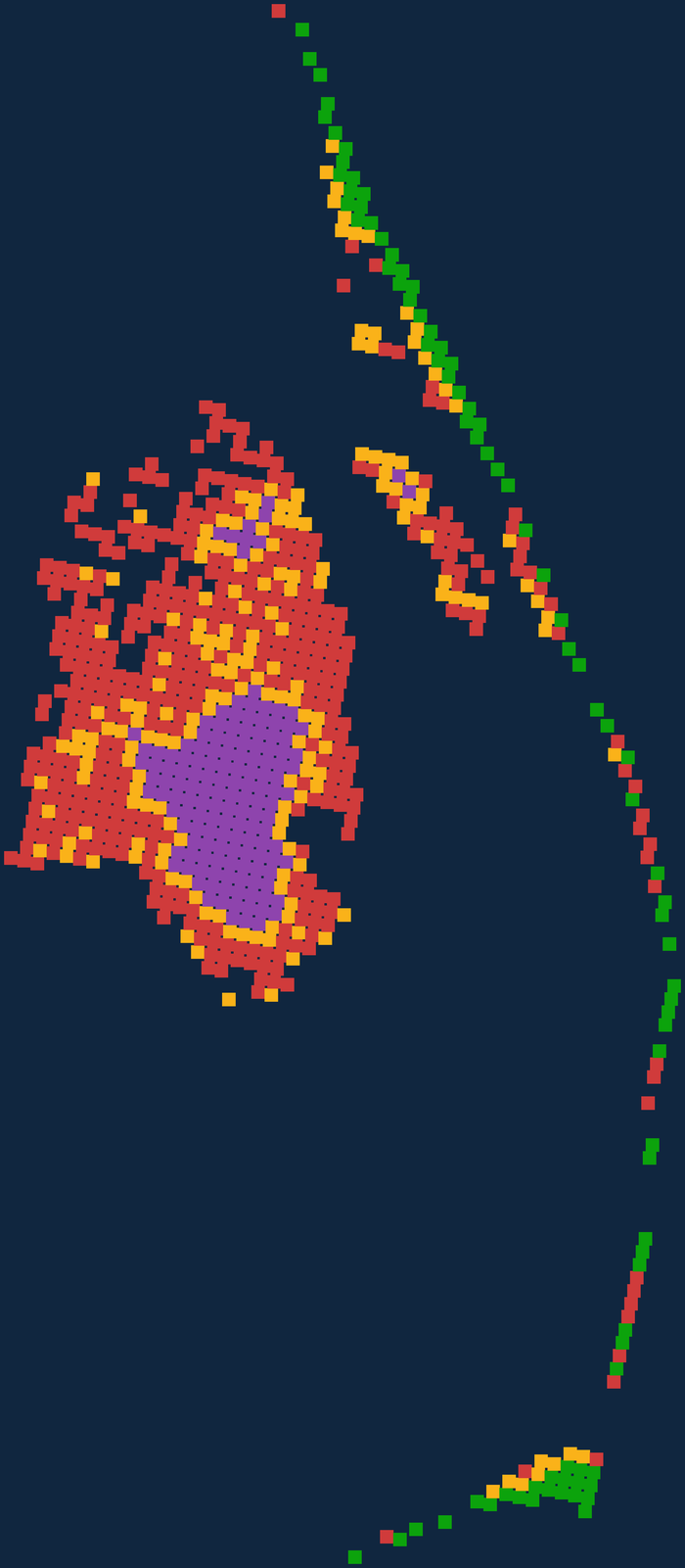
The Outer Banks, measured square kilometer by square kilometer. On the high sea-level scenario at 2055, 436 of its 857 land tiles submerge — but only 16% of the county’s best-scoring ground goes with them. The event is indiscriminate. The consequences are not.
This is the real product, not a mock-up: step five scenarios and three decades yourself, with the Arcanium Index™ over the same ground on the same page. No account needed.
More showcases: Berkeley County, SC · Central Iowa · Phoenix, AZ
Alongside the ten — measured and reported, never blended into the Index.